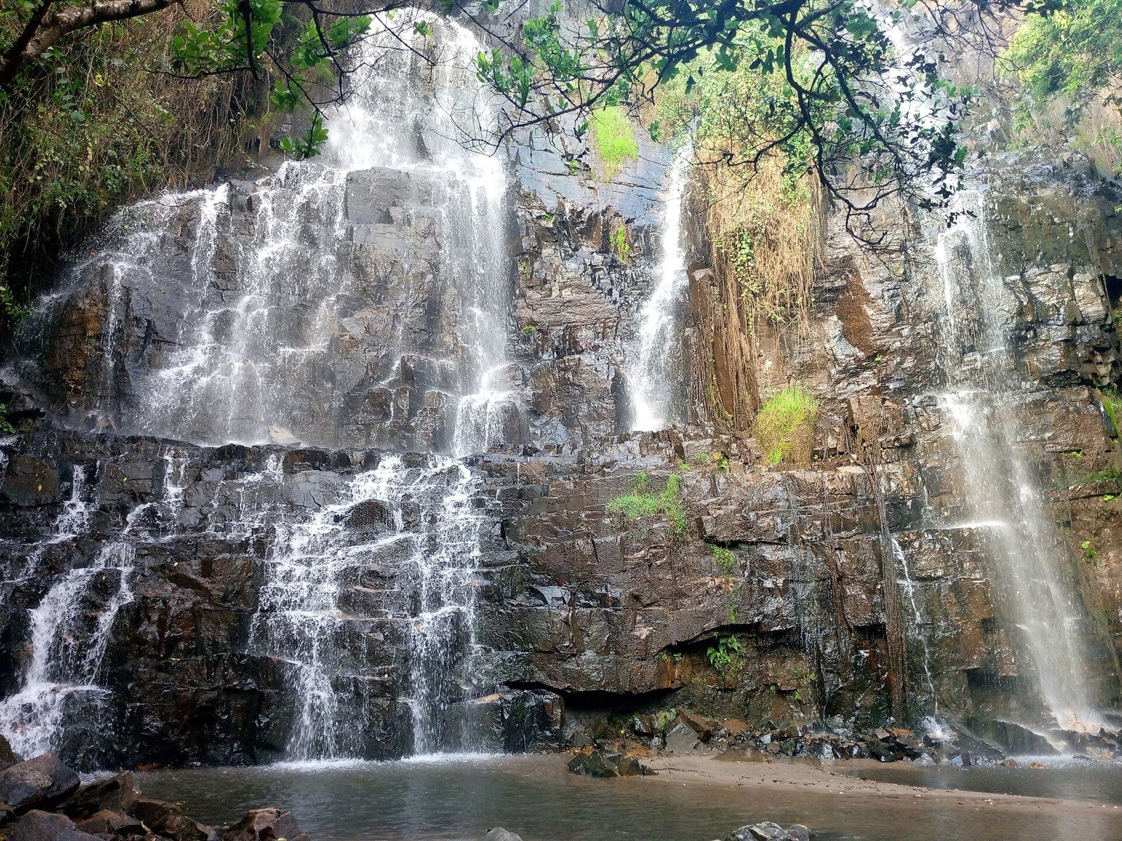
A waterfall landscape in the hills of southeastern Burundi.
The Karera falls are among Burundi’s recognised natural landmarks. Their appeal lies in the setting as well as the falling water, but conditions vary with weather and access. Treat them as a separately arranged outing, not a guaranteed roadside stop.
Explore · at your own pacePlan · sights and local lifeCheck · access before arrival
Several falls and channels form the wider landscape. Stay on routes approved by the local custodian; wet rock, steep edges and changing water flow make improvised shortcuts unsuitable.
Ask which sections of the falls are included in the agreed route. A broad waterfall name can cover different viewpoints, with different walking and access demands.
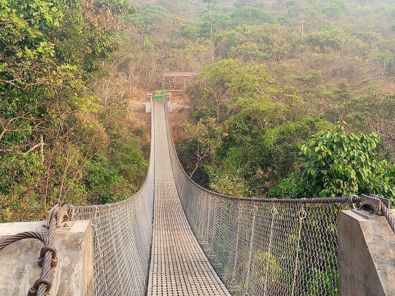
Photographed bridge on the waterfall approachZamennest · CC BY-SA 4.0 · Resized; display crop.
02
A guided visit
Confirm who manages entry, whether guiding is available and what the visit involves physically. Ask about the exact walking route rather than accepting a general assurance that it is easy.
The photographed bridge shows a particular part of the approach, not a current structural inspection. Confirm the route’s present condition and whether anyone in your group needs an easier alternative.
Images capture a particular season and viewpoint. They do not guarantee the same flow or open paths on your date, and they should never be read as advice to enter the water.
Season and recent rainfall affect both appearance and footing. The best-looking water flow in a photograph does not necessarily correspond to the easiest or safest conditions for a visit.
Arrange transport, local access and the return journey together. Check the weather and current regional advice before setting out; do not make the falls a late addition to a long driving day.
A day to make your own
Give the outing a dedicated time window with room for changes. Carry what the organiser confirms you need, keep to the agreed path and leave time to return in daylight.
Local life, one meal at a time
Eat & drink.
Confirm meal and drinking-water arrangements in advance. Do not assume there is an operating café or shop at the site.
Keep a meal break between your main sights rather than adding it after an already full day. Ask what is seasonal, what the portion includes and whether the kitchen is serving at the time you expect to arrive.
For a group or anyone with dietary requirements, confirm the menu and ingredients directly. Leave time for the conversation as well as the food.
The right base changes the visit
Where to stay.
CHOOSE YOUR SETTING
Location before labels.
Confirm the overnight base and driving plan before booking the waterfall visit. Do not assume accommodation, a restaurant or a shop operates beside the falls.
LOCAL ENQUIRIES
Confirm the exact place.
No currently operating accommodation is asserted for this destination. Use the official visitor source to identify the appropriate local contact, and check the exact address and travel conditions before making arrangements.
Arrange the vehicle, custodian or guide and return journey as one plan. Ask about walking duration, steps, slippery sections and the weather decision before departure. Do not rely on an unconfirmed roadside pickup afterward.
Useful contacts
Go to the source.
Use current official information for access and conditions, and the destination or property itself for its own services. An old photograph or previously published itinerary does not establish today’s arrangements.
Photographs are credited beside each image and may show earlier conditions. The suggested pacing and base comparisons are ATA editorial planning ideas, not bookable itineraries or guaranteed operating information.