Seychelles · A closer look

Anse Source d’Argent

Granite formations and shallow coastal views create one of La Digue’s signature settings.

Anse Source d’Argent belongs to a larger landscape on La Digue’s western side. The approach through L’Union Estate links the beach with a former coconut and vanilla plantation, while the shore breaks into small sandy spaces around enormous granite forms. Close views reveal rounded edges, grooves and changing shadows that disappear in a distant panorama. The setting is both a geological landscape and part of an island shaped by agriculture.

Granite formations at Anse Source d’Argent on La Digue
Granite formations at Anse Source d’Argent on La Digue. Photo: NorbertNagel · Wikimedia Commons · CC BY-SA 4.0. Cropped for display.
Granite formations at Anse Source d’Argent on La Digue
Granite formations at Anse Source d’Argent on La Digue. Photo: NorbertNagel · Wikimedia Commons · CC BY-SA 4.0. Cropped for display.

Granite coves and L’Union Estate

Give the shore and rock formations time without blocking paths or disturbing others. Check the current approach through L’Union Estate and any admission.

The boulders divide the shoreline into a sequence of small spaces rather than one uninterrupted strip of sand. Weathering has exposed rounded masses, curved surfaces and narrow gaps, with palms and vegetation establishing another layer behind them. L’Union’s nearby monolith belongs to the same striking granite landscape, making the approach through the estate part of the beach’s physical context.
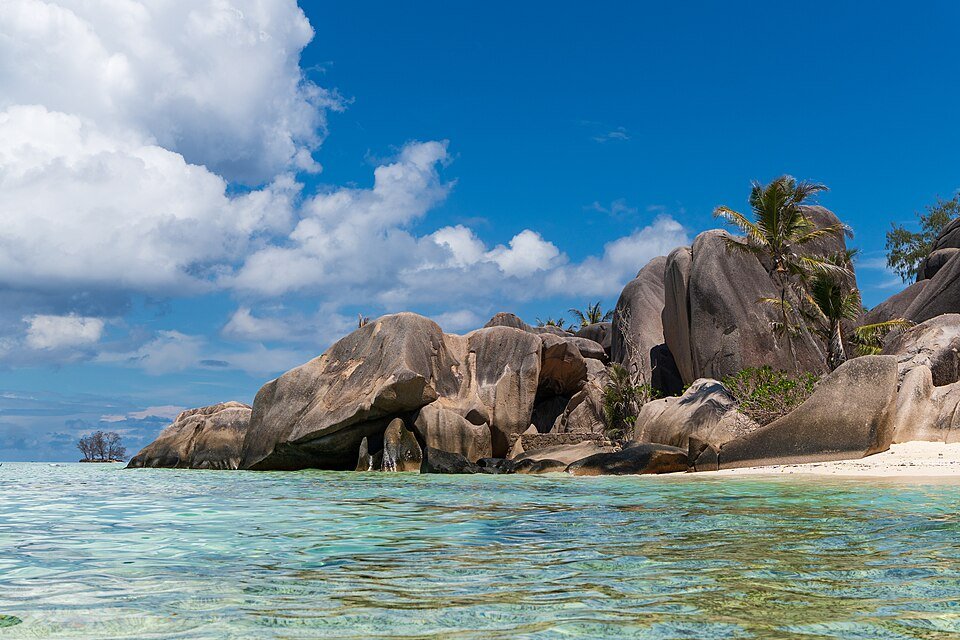
Granite boulders and shallow coastal water at Anse Source d’Argent
Granite boulders and shallow coastal water at Anse Source d’Argent. Photo: NorbertNagel · Wikimedia Commons · CC BY-SA 4.0. Cropped for display.

Water, sand and changing views

Tide, wind and currents affect the water. Ask local staff for advice and do not assume the whole coastline is suitable for swimming.

Shallow water, exposed sand and the bases of the granite rocks form a changing foreground along the beach. A different water level can reveal the shape of a cove or turn a rock into an isolated feature. The photograph records one moment in that changing coastal scene; its still surface describes the landscape at the time of photography and does not establish present swimming conditions.

Additional history and nature sources

Sources reviewed October 31, 2026.

Give the day room to unfold

Confirm current access and tide conditions, choose appropriate transport and carry water and sun protection.

Visitor information & sources

Sources reviewed 28 October 2026. Opening, access, availability and services can change.

Nearby accommodation and planning contacts →

← Return to the Seychelles guideSeychelles planning →