American Tour Association — Tourist attractions on and off the beaten path. Supporting tour operators and the general public since January 1989.

Planner Home  /  Mexico  /  San Juan Parangaricutiro

Mexico · Michoacán · Beyond the beaten path

The town disappeared.Its church still stands.

San Juan Parangaricutiro: a buried town, an extraordinary volcanic landscape, and a community whose story continued.

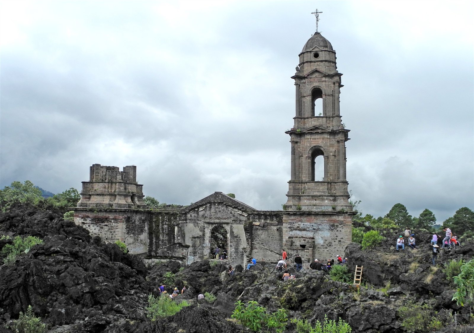
The surviving tower and façade of San Juan Parangaricutiro church surrounded by black volcanic lava
LBM1948 / Wikimedia Commons · CC BY-SA 4.0 · Resized; display crop.

Look at the tower.
Then imagine the town beneath you.

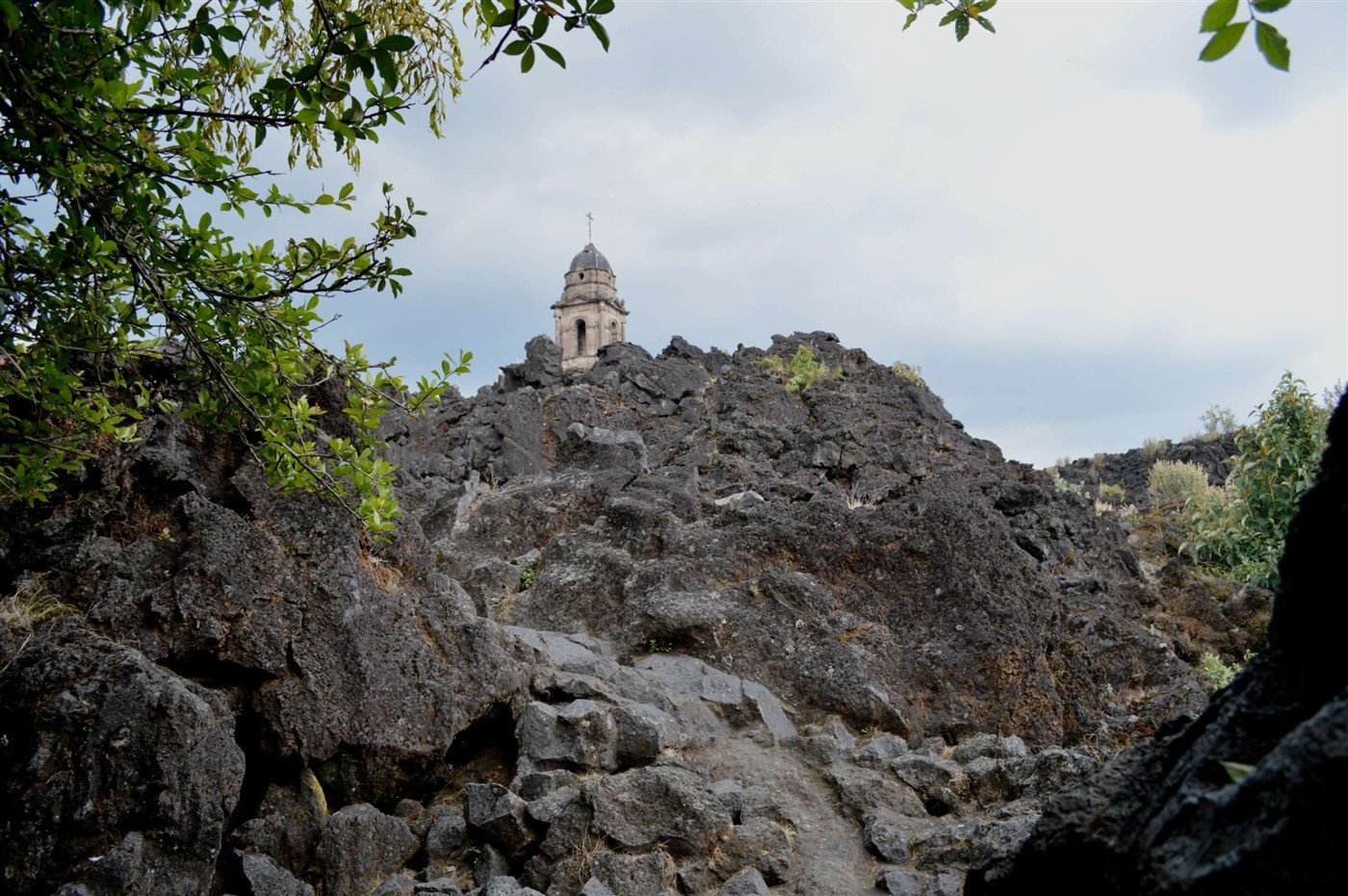
There were homes here. Streets. A place where neighbors met and ordinary days unfolded. Today, dark volcanic rock surrounds the surviving church, and the landscape asks you to imagine everything it conceals.

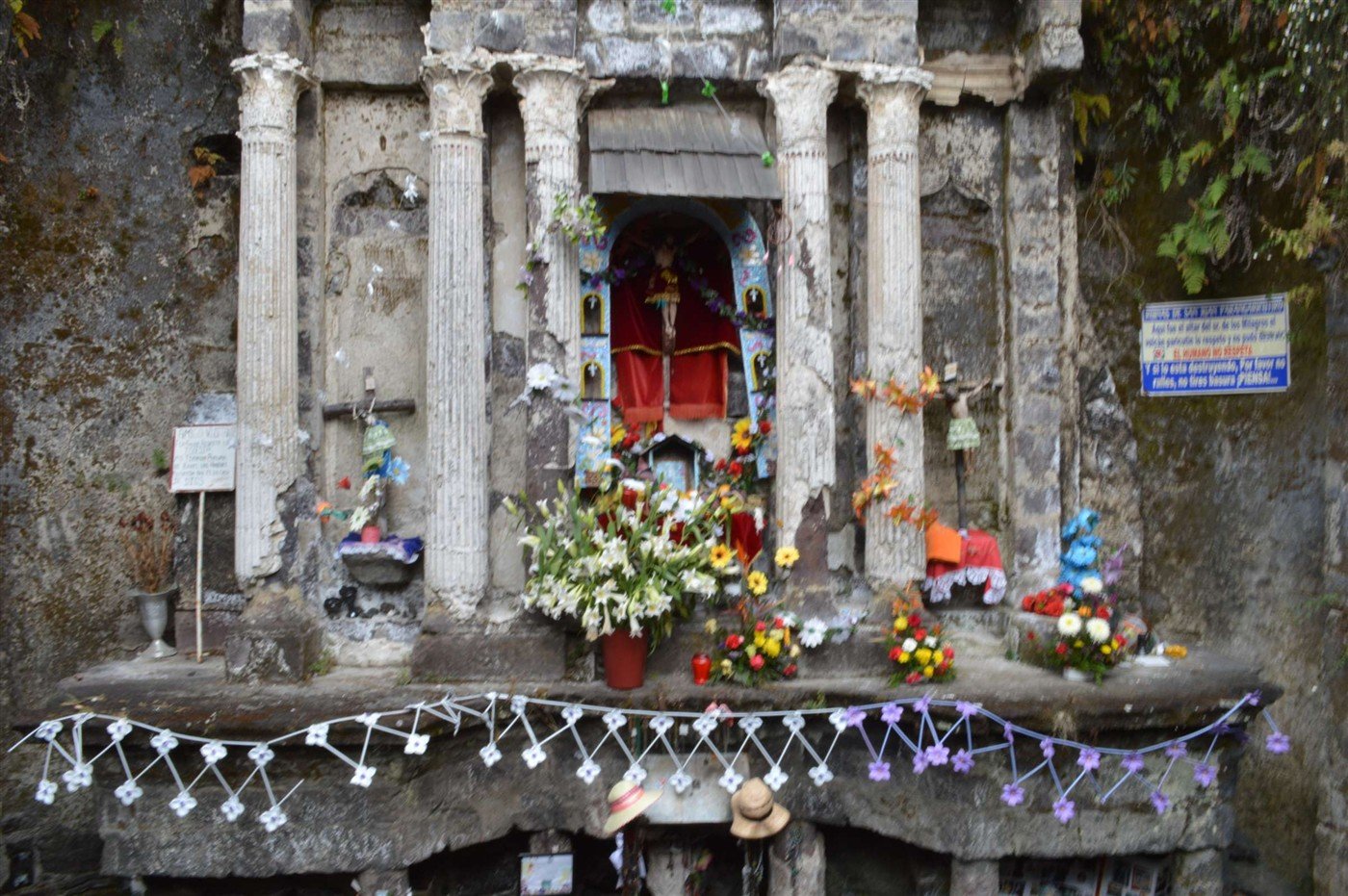
This is old San Juan Parangaricutiro, in Mexico’s state of Michoacán. The church tower is the unmistakable landmark, but it is not the only survivor: portions of the façade and the altar area also remain. Together, they mark the settlement that lava overwhelmed.

Background: Visit Mexico’s Paricutín guide.

A volcano appeared in a field.

On February 20, 1943, the ground opened on Dionisio Pulido’s farmland and a volcano began to emerge. What had been a field became the birthplace of Parícutin. Its eruption continued for nine years, offering scientists a rare opportunity to document a volcano from its beginning.

The event reshaped an inhabited landscape. Lava covered settlements, people had to leave their homes, and a new volcanic cone became part of the horizon. The church ruins bring that immense geological story down to a human scale.

1943Parícutin emerges on February 20.
1944San Juan’s community relocates as the eruption threatens the town.
1952The nine-year eruption comes to an end.

History: Michoacán Tourism; U.S. Geological Survey; INAH’s historic monument record.

The town was lost.
The community was not.

The story does not end with the lava. In 1944, residents moved to a new settlement, now known as Nuevo San Juan Parangaricutiro. They carried religious objects and materials from their old church, including the revered image of the Señor de los Milagros, into the life they were rebuilding.

That distinction matters when you visit—or search a map. The lava-buried ruins and the active sanctuary in Nuevo San Juan are different places. One preserves the traces of the old town; the other belongs to the living community that emerged from its loss.

Community history: INAH and Michoacán Tourism’s account of Nuevo San Juan.
Plan the approach, not just the photograph

How to reach the buried church.

Check the travel advisory before planning a visit.

As checked on October 23, 2026, the U.S. Department of State lists Michoacán at Level 4: Do Not Travel. Its permitted areas for U.S. government employees do not include this excursion. Read the current Mexico advisory and Michoacán restrictions; travelers from other countries should also consult their own government’s advice. The route below describes the usual approach, not confirmation that travel or site access is currently suitable.

UruapanRegional transport base
AngahuanMeet a local guide
Church ruinsConfirm the local approach
  1. Begin with Uruapan. This is the usual regional base for organizing transport and an excursion. Ask your accommodation or a reputable local operator to confirm current road conditions and whether the trip is operating.
  2. Arrange a road transfer to Angahuan. A local operator quotes approximately 45 minutes from Uruapan by car; allow extra time for road conditions and stops. Agree on your return arrangements before setting out.
  3. Request the church ruins specifically. In Angahuan, ask for the “ruinas de la iglesia de San Juan Viejo Parangaricutiro.” Local guides offer walking and horseback excursions. Confirm the terrain, final walking section, total duration, guide language, and price before agreeing.
  4. Decide whether you want the church or the crater. The volcano-crater excursion is a longer, more demanding outing. Tell your guide if your priority is the buried church, and do not assume a full volcano tour has the same timing or physical requirements.

Route overview and quoted driving estimate: SEO Paricutín / Senderismo Puro, a local tour operator. Angahuan’s guiding and horse services are also described by Michoacán Tourism. Confirm details directly.

A map pin is a location reference, not a verified driving or walking route across the lava.

Protect the church—and yourself. A local operator’s June 2026 notice prohibits climbing the church, tower, and walls. Confirm current restrictions before departure, obey barriers, and follow your guide’s instructions. Older photographs may show access that is no longer allowed.

Make the day work for you.

  • Wear sturdy footwear with grip for uneven volcanic rock.
  • Bring drinking water, sun protection, and a layer for changing weather.
  • Ask about current toilets, food, payment arrangements, and mobile coverage before leaving Angahuan.
  • If stairs or rough ground are difficult for you, discuss access with the operator first. A horseback option does not guarantee an accessible final approach.

For group tour operators.

Confirm road access for your vehicle, parking or transfer arrangements, group size, language, walking demands, local guiding, and a realistic return time. Check current advisories before adding the excursion to an itinerary.

For hotel arrangements or planning assistance, tell ATA about your group →

A remarkable place. A story that stays with you.

The photograph catches your attention. The deeper story is about a landscape transformed and a community rebuilding its future. Keep both in mind when you explore the history of San Juan.

Photography, sources & visitor information

Church façade: LBM1948 (2013). Lava-field and altar photographs: AlejandroLinaresGarcia (2015). All three photographs are used under Creative Commons Attribution–ShareAlike 4.0. Images have been resized for web use; hero and card displays may crop them. The resized photographic adaptations remain available under the same license; click each photograph for its full image.

Historical and visitor sources are linked beside the relevant sections. Information checked October 23, 2026. Local conditions, restrictions, services, and advisories can change.